At a recent meeting at Hamburg Hall, the home of the Heinz College of Information Systems, Public Policy and Management, an interdisciplinary group of faculty and students from across the university's five colleges gathered to discuss efforts to combine 'technology and policy to transform city life.'[1] The meeting included short presentations of projects supported by a recent round of grant support, including technical frameworks for smart traffic control, VR technologies for urban design, and computational analysis of data about pedestrian movements in street intersections. A participant explained the vision to 'leverage technology and policy innovations, and interactions between the two, to dramatically transform the quality of life in metropolitan regions' and to 'develop twenty-first century solutions to the challenges facing [cities].'
Before Pittsburgh acquired its reputation as a technology, education, and health hub, or became the launchpad for Uber's autonomous cars, it had long been a laboratory for the application of computational approaches to urban questions. Since the 1950s the federal and city governments, in partnership with community organisations and universities, supported multiple efforts towards urban renewal and community development. Important among these was the federally mandated Community Renewal Program (CRP) initiated in 1959 to incorporate community development concerns along with transformations in the physical structure of the city, which was the first to experiment with computers and simulations in urban design.[2]
Pittsburgh's early ventures into computational urban projects can be seen as illustrations of a broader post World War II conjunction of military and urban expertise. As historian of science and technology Jennifer Light writes, '[i]n a climate of concerns about reducing urban vulnerability to atomic attack, military strategists, urban planners, atomic scientists, social welfare advocates, and local government officials came together for a sustained conversation about improving the nation's physical and social infrastructure in the post-war period.'[3] These collaborations effectively sought to transfer the perceived successes of the US military, including its use of computer simulations, to what was understood as the new battlefield: the post-war American city – and Pittsburgh was a textbook example of both its pitfalls and opportunities.[4]
An apt illustration of this alignment is the 'Lowry model,' an early urban simulation developed in the early sixties by Ira S. Lowry, a RAND corporation researcher working in the city.[5] Lowry sought to model the dynamic evolution of cities by relating factors such as population, employment, tax revenues, demand for public services, and land use. His model, which was implemented as a computer programme with the help of Carnegie Tech faculty, was the root of a host of predictive urban simulations which continue to be used by urban planners today. It also shows how in the social and intellectual ecosystem of the post-war period computers started to creep into the frame of urban planning, policy, and design. An iterating question may be: how did these moves shift the intellectual centre of gravity of nearby architectural educators and researchers?

The ‘Lowry Model’ is an early example of predictive urban simulation, modelled Pittsburgh's economy through causal relations between elements such as taxes, population, and density. Lowry S. Ira, A Model of Metropolis, Santa Monica, CA: RAND Corporation, 1964. https://www.rand.org/pubs/research_memoranda/RM4035.html, 5.

Pittsburgh city map divided into one-square miles. Lowry S. Ira, A Model of Metropolis, Santa Monica, CA: RAND Corporation, 1964. https://www.rand.org/pubs/research_memoranda/RM4035.html, 109.
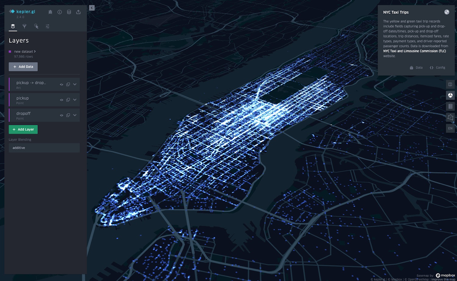
Uber’s Kepler.gl platform for urban simulation and visualisation is used by the company to predict demand based on user data. The platform was made open source. Image credit: Renato Arbex.
Comments